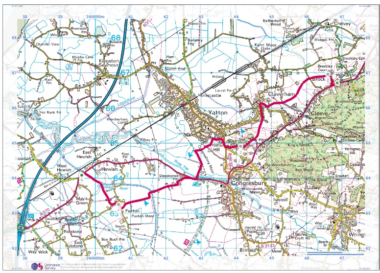
North Somerset: Brockley to Hewish
An easy walk taking in two CCT churches, two nature reserves and site of an iron age hill fort.
Getting there:
Start: St Nicholas' Church, Brockley
Make your way to the St Nicholas’ Church from the bus stop walking south following the brown Historic Church sign. After having a good look around this small originally Norman church, walk to the right from the gate along a lane/track to cross Littlewood Lane and then over some fields to cross Meetinghouse Lane. Here take the path directly forward which crosses further fields to come out on Bishops Road at Claverham. Turn right and follow the road passing the school to the left and turn down Chapel Lane. This path takes you down beyond the houses into open fields to Blind Lane where you turn right and along to the entrance to Cadbury Hill. There are various paths up over the ramparts to the top of the hill. Continue over the hill taking in the extensive view to nearby Congresbury below and the Mendips, Crooks Peak and Brean Down in the distance.
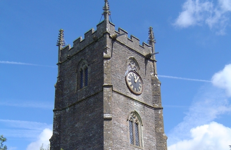
Walking in the south westerly direction past the quarry on the right, go through a gate onto a path going down through trees and a lane to the road. Here turn right for 200m in the Yatton direction crossing the road and turning left at Mendip Road. After walking through the houses take the footpath on the left and into a field bearing left to cross into the far corner of the field and go onto a track alongside a water channel to the Strawberry Line cycle path. Here turn left and follow all the way to the Congresbury Yeo and the main Weston Road. Here turn right and walk alongside the road for around 200m then cross to go down Old Weston Lane and a little further on left onto Dolemoor Lane. Continue on Dolemoor Lane as it bears to the right and later crosses two bridges to the entrance to Puxton Moor and Nature Reserve. A path will take you directly across the moor to Puxton Lane. Here turn left and at the bend take the footpath across the field to Holy Saviour’s Church with its distinctive leaning tower.
On to Palmers Elm (Hewish) bus stop (approx 1 mile)
From the front of the church walk out onto Puxton Lane turning left and take the marked footpath a little way on the right. This takes you across a field and a lane. In the next field cross to the gate at the far corner and bear left to the bridge across the water channel. Then turn left walking beside the water channel to the road. The bus stop is to the left.